
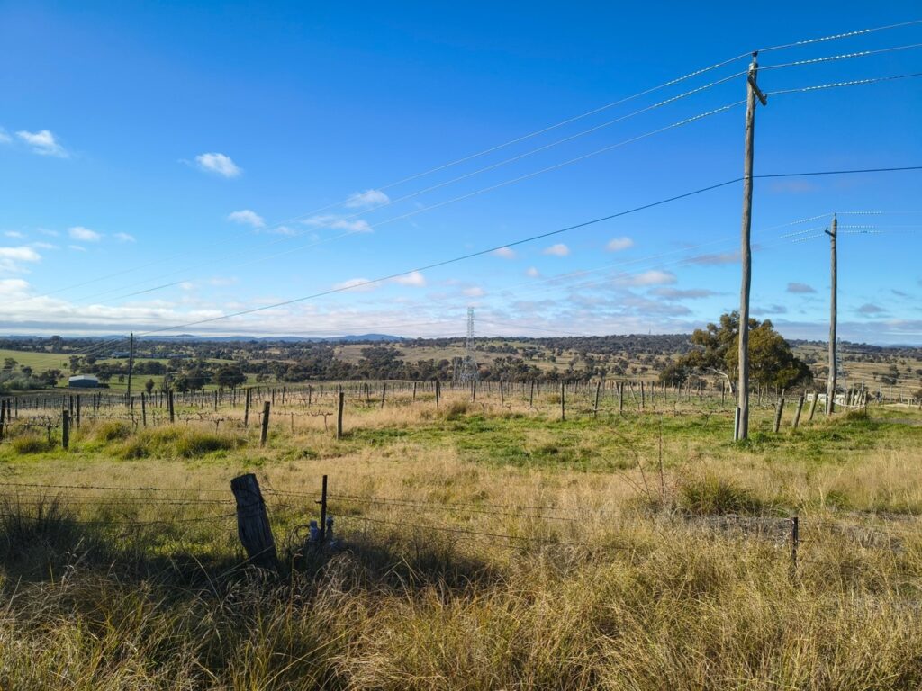
The vineyard surrounded by distant box-gum grassy woodland where the government wants to build more urban infrastructure, viewed from the road.
The ACT government is proposing to amend the Territory Plan to permit a ‘recycling facility’ and ‘bulk landscape supplies’ as a land use for a 5.08 hectare former vineyard in southwest Belconnen, known as Block 1653.
Block 1653 sits right in the middle of ecologically sensitive land south of Drake Brockman Drive and East of Stockdill Drive. The site is a former vineyard that is part of a blue-green ecological network of nature reserves, and other area-based conservation measures, connected by ecological corridors to the Molonglo River, according to the Belconnen District Strategy 2023.[1] It includes farms producing food and wool and forms a rural landscape backdrop which gives local residents, who live in the expanding suburban sprawl, access to scenic beauty and recreation.
The National Capital Authority (NCA) is required by law to ensure Canberra’s distinct towns are set in broad landscaped valleys. But it has agreed to enable high traffic from large trucks, pouring of concrete to create a facility costing $8.5 million, and permanent composting which may cause ‘runoff, erosion, and degradation of nearby waterway impacts as a result of stockpiling and material handling.’ If this goes ahead, there is a risk of potentially harmful runoff down the ‘natural drainage lines that flow southward toward the Molonglo River.’[2]
We are shocked that the ACT government is pushing forward with placing this suburban waste infrastructure in the Western Edge Investigation Area (WEIA), when it also says ‘there has been no Government decision made as to whether any development will proceed in the WEIA.’[3]
Even more concerning, the block is situated in Central Molonglo, which the government removed ‘in perpetuity from being considered as a future urban area’ in 2008.[4] This is an area where farmers make a living, and a haven for our slow-growing box-gum grassy woodland and iconic wildlife.
The Design Options Study makes it clear that the recycling facility and bulk landscape supplies are just stage one in the ACT government’s plan to build a much larger Resource Management Centre, including landfill, perched right above the Molonglo River where runoff and rubbish could harm native fish, birdlife and platypus.[5]
The draft is open for consultation and written comments will be accepted until 3 August. To find out more, please go to the ACT Government’s Major plan amendments webpage.
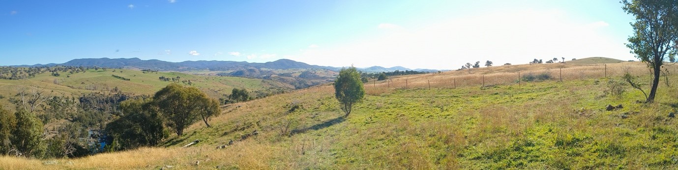
The ACT government is considering placing a new landfill tip in the Western Edge Investigation Area on block 1634, shown by the yellow grass behind the fenceline at the top right of this photo. Runoff would flow down the steep slope into the Molonglo river at bottom left.
[1] See Planning (Belconnen) District Strategy 2023 https://legislation.act.gov.au/ni/2023-531/, p.40.
[2] See the Draft Major Plan Amendment 14 ‘Supporting Report’ on the ACT government’s website, https://www.planning.act.gov.au/professionals/our-planning-system/the-territory-plan/major-plan-amendments, pp. 8 and 6.
[3] See https://www.planning.act.gov.au/planning-projects/western-edge-investigation
[4] Planning and Development (Plan Variation No 281) Direction 2008 Molonglo and North Weston (NI2008 351), www.legislation.act.gov.au/View/ni/2008-351/20080822-37459/PDF/2008-351.PDF, point 3 in Annexe A
[5] See the Draft Major Plan Amendment 14 ‘Design Option Study’ on the ACT government’s website, https://www.planning.act.gov.au/professionals/our-planning-system/the-territory-plan/major-plan-amendments